What We Do

Drone based Building Construction Aerial Photography Videography progress inspections projects. Pictures Over Stillwater performs drone based Construction Aerial Photography, Videography, Photogrammetry imaging (2D, 3D, Mapping), are among Pictures Over Stillwater focus areas. Our construction experience spans from design phase pre-build virtual outward looking views to support Building Information Modeling (BIM), to one-off ad-hoc marketing “Hero” shots. Our project experience includes FPV fly through virtual tours, special events (ground breaking, top-off, major milestones), to recurring activity indoors and outdoors on projects spanning multiple years.

Article – Drones in Construction
Photogrammetry 3D Model Digital Twin Demo
Old Washington County Courthouse Stillwater MN
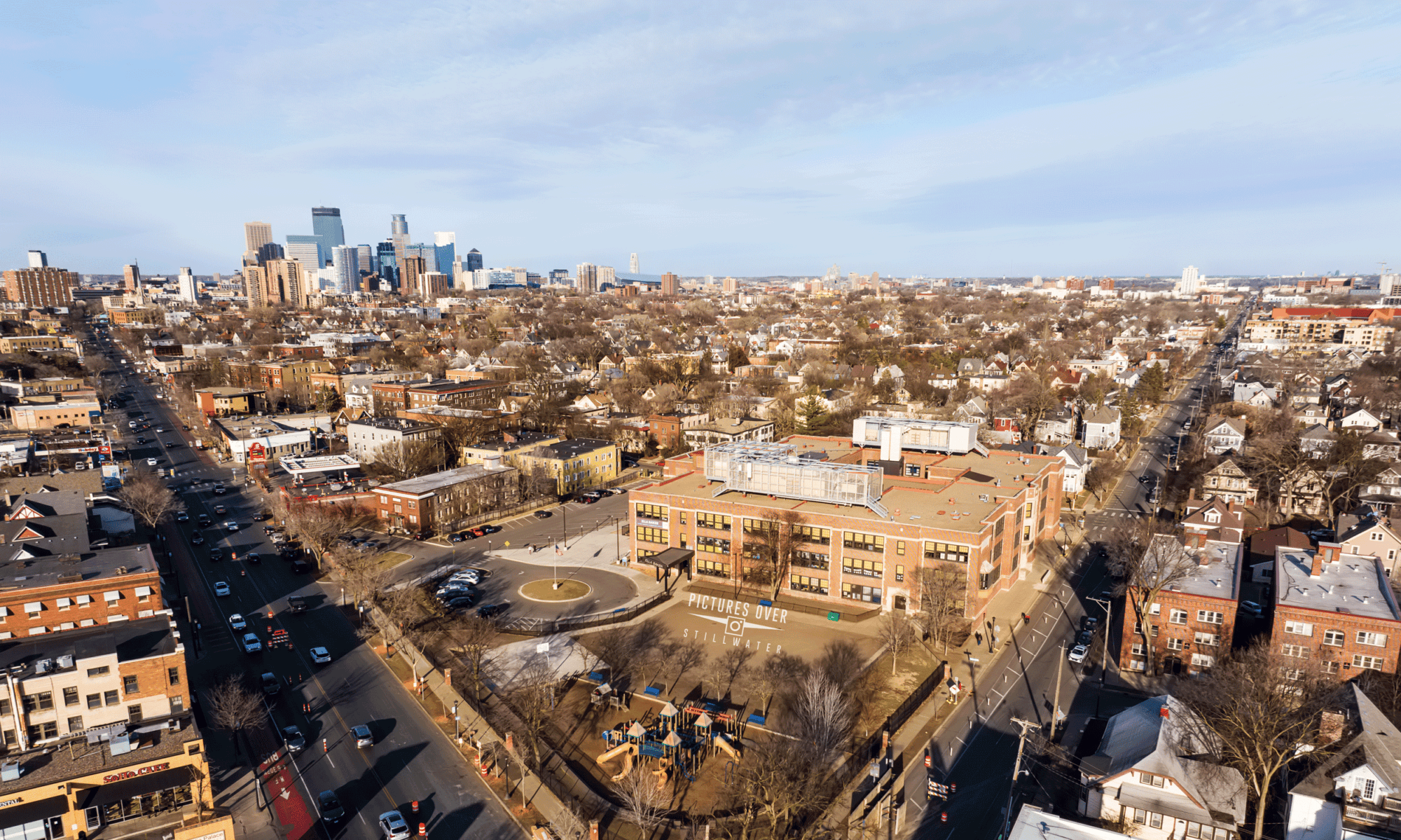
Where We Have Done Work
We have done residential and commercial construction aerial photography videography imaging mapping and virtual tour projects from western Wisconsin to the west metro, from norther to southern suburbs, as well as throughout the greater Minneapolis St Paul Twin Cities metro area.
Our project experience includes flying in restricted no fly zones adjacent to major airports where special coordination and airspace from the FAA has been required, to flying in controlled airspace with normal FAA airspace authorization, as well out in the middle of farm fields and empty lots.

What We Have Done
Pictures Over Stillwater recurring construction drone aerial photography videography and imaging experience includes both hand flying, as well as autonomous (programmed) missions to capture view perspective that are the same (height, location, focus point) for each flight for long term time lapse comparison and progress reporting. Image capture (indoor and outdoor, ground and aerial) includes still photography, video, imaging mapping (2D, 3D), oblique, nadir, time lapse, panoramic, as well as 360 (still, video, time lapse).

Our project portfolio experience includes fly and capturing image of undeveloped properties ranging from an acre to over 200 acres, from horizontal below grade infrastructure and utilities site prep to tall vertical structures above ground. We have captured imagery from inside and outside, on the ground, to high over tall buildings in downtown Minneapolis and St Paul.
Pictures Over Stillwater construction aerial photography videography experience includes close up inspections of roofs and other items, to wide view images, from single residence to large multi-story structures, from a few thousand to hundreds of thousands of square feet in size.

2022 Demo Reel Indoor Outdoor Aerial Video Views
Sampling of what we have done around the Twin Cities metro area:
✓ Capture ground and aerial, indoors (including drone) and outdoors
✓ One off inspections of roofs, buildings, towers and other structures
✓ FPV fly through virtual tours inside and outside
✓ Building facades, oblique and ortho among other views
✓ Recurring projects spanning days, weeks, months and years
✓ Fly in, fly through and look around views plus traditional views
✓ Fly autonomous missions with Litchi, DJI, Autel, DroneDeploy, Pix4D
✓ BIM content for Pix4D, DroneDeploy, Cupix, ODM among others
✓ Virtual views from locations during design and before build
✓ Fly in, around, outside of buildings including high-rise structures
✓ Fly indoors down an elevator shaft and into a large HVAC air duct
✓ Capture images in close proximity to cranes and helicopter lifts
✓ Capture aerial views of heavy lift structure top off events
✓ Ground breaking, special events, major milestone
✓ Year round from heat of summer to below zero winter weather

Who Have We Worked For
Pictures Over Stillwater has captured ground and drone based construction aerial photography videography, imaging and other content for local, regional, and national land owners, property developers, designers, architects, engineers, general contractors, subs including mechanical, roofing, site prep excavators, suppliers, owners as well as third parties and service providers.

What We Can Do For You
One off, standard packages and custom solutions for inside, outside, on and from the ground as well as drone based aerial creative services content capture and creation. Still photography, videography, photogrammety mapping model 2D 3D image capture, 360 (still, video, time lapse), panoramic, oblique, spherical, time-lapse, live real-time video feeds as well as audio.
✓ Capture images and upload for you or your service provider
✓ Post production services including video, photo, 2D 3D maps models
✓ Augment your staff or creative services departments capabilities
✓ Provide drone operation training and flight operations reviews
✓ Assist your staff with flight planning, waivers, airspace authorizations
✓ Capture before, during and after images of structures
✓ Architect, Design, Engineering, construction BIM content
✓ Structure placement studies and content capture
✓ Views of where structure will be and is being constructed
✓ Outward views of where structure will be or is being built
